Aerial Archives as a Key to Civil Safety
More than eighty years after World War II, unexploded ordnance remains a serious hazard in many European countries. In areas once heavily bombarded, buried bombs still endanger construction and infrastructure projects, requiring thorough risk assessments before any excavation. Bomb disposal teams rely on historical aerial reconnaissance imagery to identify possible impact sites – an intensive manual process involving the visual inspection of hundreds of photographs. Automating parts of this analysis can dramatically accelerate evaluations and enhance safety through intelligent, AI-assisted pre-screening.
The Limits of Current Workflows
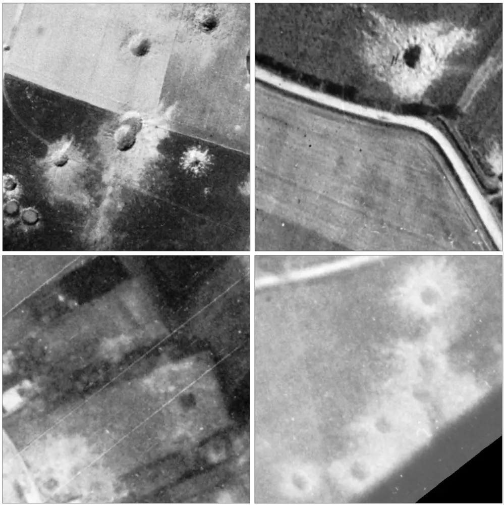
Identifying bomb craters in historical imagery remains a demanding and time-consuming task. Each photograph differs in lighting, contrast, scale, and quality, often further degraded by age or scanning artifacts. Terrain variation, atmospheric influences (clouds, haze), and shadowing often obscure crater shapes, making consistent interpretation difficult even for trained analysts. As archives comprise large numbers of heterogeneous images, exhaustive manual inspection is challenging, while traditional image processing techniques struggle with the immense variability and often poor quality of images.
Deep Learning for Civil Security
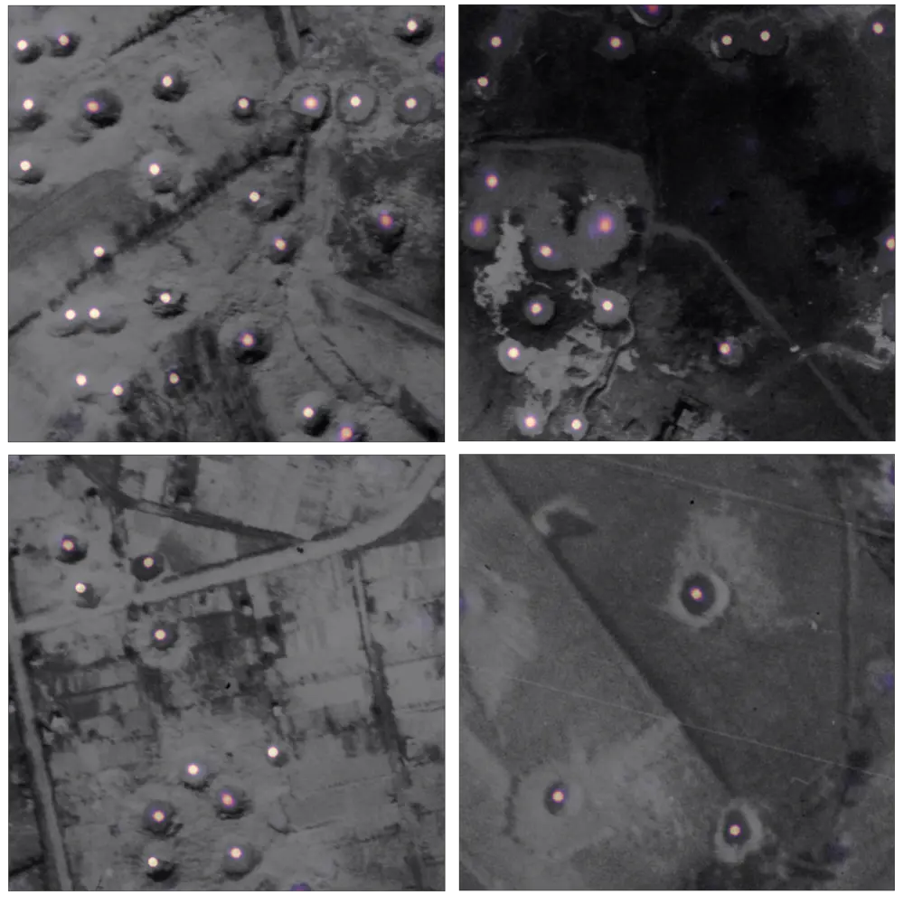
To address these challenges, a deep learning approach is being developed to automatically detect and localize bomb craters in historical aerial imagery. Using a customized convolutional neural network, the system analyzes grayscale scans from 1940s reconnaissance photographs to identify craters with high spatial precision. Each detection receives a probability score, enabling experts to focus on the most relevant areas while large archives are processed automatically – bridging human expertise and AI for faster, more reliable assessments of unexploded ordnance risks.
From Image Archives to Actionable Insight
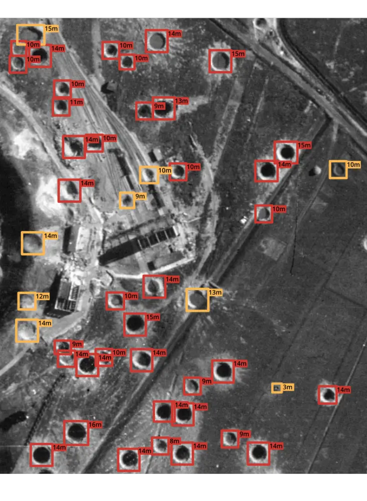
Integrating deep learning into aerial image analysis transforms historical archives into a powerful source of geospatial intelligence. Beyond detection, such a system may extract quantitative information – such as crater size, shape, and spatial distribution –offering deeper insight into each impact site. These attributes support the assessment of bomb types, damage extent, and potential presence of unexploded ordnance. Automated pre-analysis reduces manual workload, while structured, data-driven outputs enhance expert evaluations and enable more targeted field verification.
Toward an Evolving Intelligence System
The approach demonstrates how artificial intelligence can transform historical imagery into actionable insight for safety and planning. As models and data continue to advance, such systems will further enhance accuracy and scale. Combining automation with expert oversight ensures both reliability and adaptability – laying the groundwork for a continuously improving analytical framework in civil protection and geospatial intelligence.
Explore Further
To learn more, read our conference paper at IEEE International Geoscience and Remote Sensing Symposium (IGARSS) 2024.