A Foundation for Agricultural Intelligence
Accurate information on agricultural fields is the starting point for many applications in farming and food security. Whether for crop monitoring, yield estimation, production trends, or risk analysis, precise and up-to-date field maps are essential for any analysis. Traditional survey methods like field campaigns and manual delineation, however, are costly, time-consuming, and difficult to scale across regions or entire countries. Timeliness is also limited and it is not possible to capture rapid changes in agricultural landscapes due to shifts in cropping patterns, natural disasters, migration, or conflicts. As a result, field maps are often either outdated or lacking entirely.
Automated Field Mapping
Panopterra’s patented Field Extraction system (EP4296969A1) addresses this challenge by turning Earth Observation data into geolocated field polygons automatically. Going beyond a standard field boundary detection, our system automatically produces a full geospatial vector layer that can be integrated directly into GIS or applied in downstream analytics such as classification, monitoring, and forecasting.
Our Unique Approach
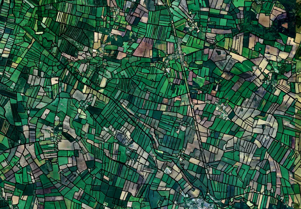
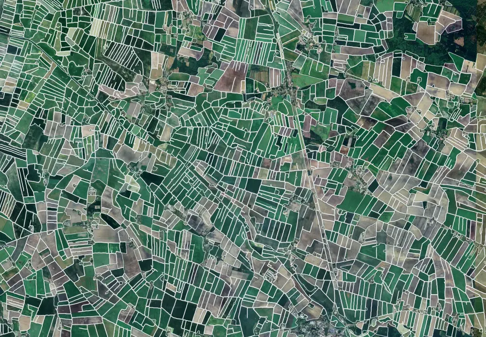
Field Boundary Detection
We apply advanced deep learning models to reliably detect field boundaries across a wide range of landscapes, using both single- and multi-temporal Earth Observation imagery. By leveraging temporal data, the system can adapt to cloud cover, haze, or other atmospheric effects, minimizing gaps in coverage and ensuring consistency. This flexibility makes it possible to generate accurate field maps regardless of season, crop management stage, or cultivation cycle. The output is a geospatial boundary probability raster.
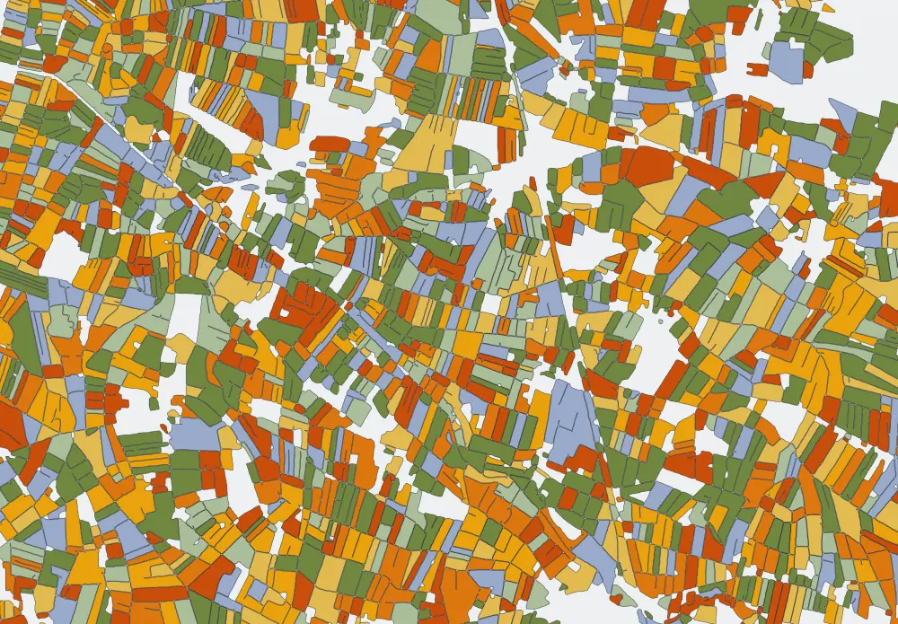
Field Polygon Extraction
The automated field extraction process is specifically designed for large-scale applications, with the capacity to map millions of individual fields across extensive study regions or even entire countries. Each extracted polygon undergoes refinement, where boundaries are corrected, geometries validated, and duplicates removed. This ensures that the resulting dataset is both precise and consistent. The final product is a clean, high-quality geospatial vector layer that integrates seamlessly into GIS and downstream workflows.
A Wide Range of Applications
Field Extraction is delivering value to a broad spectrum of users – from agricultural organizations to research institutions, government agencies, and private companies. By providing fundamental datasets quickly, consistently, and at lower cost, our system can establish a reliable foundation for various applications such as crop type mapping, land use change detection, food security monitoring, and agricultural statistics. When applied at national or continental scales, it enables more accurate, timely, and comparable statistics.
A Cornerstone for Data-driven Agriculture
Field Extraction is more than a technical solution – it is a cornerstone of data-driven agriculture. By combining scientific rigor with scalable automation, it enables timely insights that support smarter farming, food security, and informed management.
Explore Further
To get more information on our Field Extraction solution, you can get additional material below.
For a hands-on experience, have a look at our demo.