Environmental Monitoring Gaps
Uncontrolled or poorly monitored waste sites do not have adequate safeguards, presenting a significant environmental risk and causing degradation of the surrounding land, air, and water. Many sites operate without proper registration or persist after official closure, often in remote or inaccessible areas. Interpol and the United Nations have identified illegal waste disposal as one of the fastest growing areas of organised crime.
Conventional monitoring methods such as field surveys or aerial inspections are costly, time-intensive, and typically limited to small regions. As a result, there is often no consistent, up-to-date picture of waste activity and its spatial extent. The need for a scalable, reliable detection method has therefore become increasingly obvious.
Our Partner – Air & Space Evidence
Air & Space Evidence is specializing in investigating illegal waste disposal, monitoring environmental compliance and supporting legal and asset management decisions through the use of Earth Observation data.
Together, we aimed to advance their earlier Waste from Space approach through deep learning and automated image analysis. The objective was to deliver a system that helps experts identify and locate landfill sites efficiently.
A New Approach
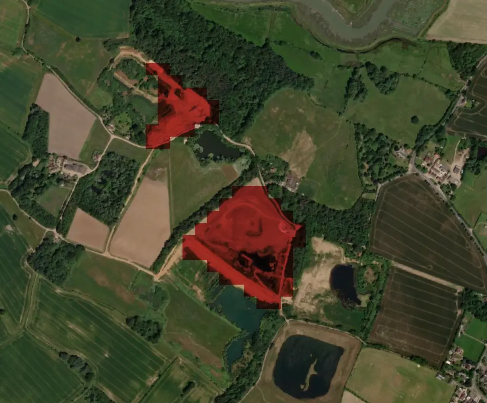
Our solution combines satellite Earth Observation with advanced deep learning to detect and map potential landfill sites automatically. Using multispectral imagery from Sentinel-2, it identifies characteristic visual and spectral patterns that indicate the presence of waste deposits. By analyzing multiple observations across time, the system distinguishes between actual landfill sites and other, often confused structures such as bare soil and fallows, construction sites, or large open air storage facilities. This helps map potential points of interest on a regional or national scale.

The Underlying Technology
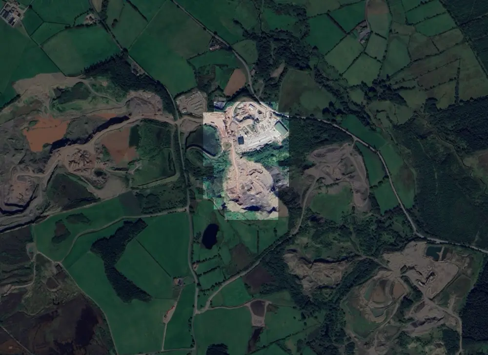
At the core lies a deep learning model trained on multi-temporal Sentinel-2 imagery. It analyzes visible, near-infrared, and shortwave infrared bands to detect characteristic landfill signatures, detecting not just entire sites but even highlighting specific parts. Using semi-supervised learning and data augmentation, it performs effectively even with limited training data. Post-processing refines detections by filtering duplicates, and prioritizing the more important sites for review. Once configured, the workflow runs automatically and can scale to national coverage.
Real-World Applications and Value
The system provides a consistent and objective method to identify illegal or unregistered waste disposal sites. It serves as the first step in a full investigation pipeline by efficiently scanning hundreds of satellite images across extensive regions and highlighting areas that merit expert review. Designed to complement existing monitoring workflows, it significantly accelerates the search and evaluation process. By reducing reliance on manual surveys and delivering repeated large area coverage, it combines cost efficiency, processing speed, and operational scalability.
The Outlook
Satellite-based monitoring is redefining how environmental change is observed and understood worldwide. As access to high-quality data and advanced analytical methods expands, detection capabilities will continue to improve in precision and reliability. In applications where reference data remains limited, an adaptive deep learning framework – continuously refined through expert input and validation – can create a powerful feedback loop, steadily improving accuracy.